I've been a big fan of the EdTechTeam and their awesome summits providing meaningful and exciting edtech PD for teachers. They have also branched into online learning and offer a multitude of great courses through EdTechTeam Online. These course focus on GSuite tools for education, Apple Teachers, Paperless classrooms, assistive technology, teacher leaders, and other critical teaching tools and strategies. Courses are anywhere, anytime learning that can be taken for graduate credit. This summer I took their Creating Global Learners with Geo Tools course and was pleasantly surprised at the power of GSuite tools like Google Maps to enhance a teacher's lesson in far more areas than just Geography.
Being an extensive GSuite for EDU user I was amazed at all the new tools and ideas I gained from taking this course. The possibilities of utilizing Google Maps to teach a multitude of subjects and help students gain a global perspective is seemingly endless! One of the things that really stuck out to me was the http://www.geteach.com/ map comparison engine. I see a lot of use of this tool for students to get amazing visuals on data that can be used for a lot of teaching purposes. Another tool that I really saw the benefit of was using My Maps as an alternative presentation tool for teachers and students that helps look outside of their world. The Google Lit Trips is a great place to get started and I plan on sharing that right away. I really hope to promote the use of this with the teachers in my school and get the students engaged in different and broader way than they are used to.
Here are some of the resources I explored in the course that really stuck out:
Google Art Project - Great resource to expose students to digital media resources for history and art. Specifically, the historical figures section provides access to great pictures and primary sources that can be used for students to create their own narratives about a figure and then do some research to compare stories and facts. Google Crisis Map - Interactive Map allows students to layer various types of data about various crisis situations nationally and worldwide. The weather, hazards, emergency preparedness map would be a great basis to teach students how to collect data and analyze patterns from different regions with other corresponding data to make their own hypothesis on why the weather and hazards may be occurring. GeoGuessr - Game that uses Google Street view to give clues about a mystery location in the world. Great way to teach students to use context clues to be able to narrow down a location based on what they can see and what makes sense in a particular region. Into the Wild map - My Map creation of the locations visited by Christopher McCandless from the story Into the Wild. This could be used as an example of how students could use My Maps to create their own maps based on a book they’ve read. Including links and other resources at various locations mapped from their story. Google Street Art - Access to audio tours, online exhibitions, world collection, and artist stories to provide students access to a genre of art that isn’t always easily accessible and can be just as moving as traditional art. Good way to get students interested in art who may not be interested in traditional art.
My final project was to create a lesson using My Maps to help students become better global citizens and understand a larger impact they and others have on our world. I chose to focus on population growth and what it could mean for various places and cultures around the world. Use the button below to access the lesson plan and feel free to use it or modify it for yourself.
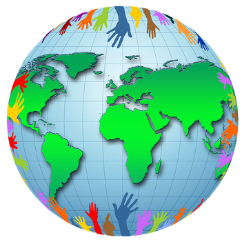
My post may have given you some insight to how tools like My Maps can greatly enhance your teaching and students' path to becoming global learners, but there's nothing like the real thing. Go check out the EdTechTeam Online learning place and take advantage of some great courses they have to offer. Feel free to comment below on any ways you've helped your students become global learners or utilized tools like My Maps in your teaching.
0 Comments
Your comment will be posted after it is approved.
Leave a Reply. |
About EvanDirector of Technology for Traverse City Area Public Schools. Level 2 Google Certified Educator. Former Tech Integration Specialist and 4th grade teacher at Aspen School District and Spartan for life! Go Green! 
Categories
All
Archives
February 2019
|
 RSS Feed